


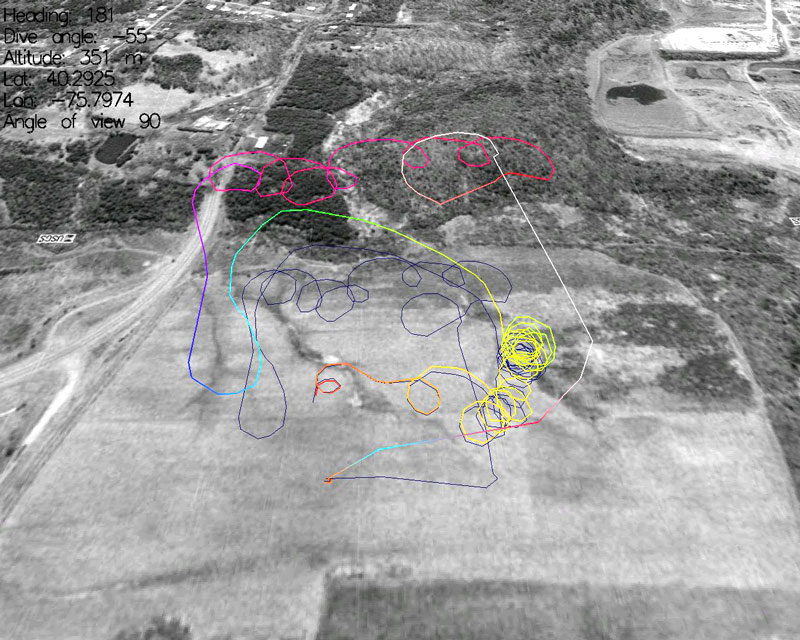
Normally, I don’t post stuff about my model sailplane hobby, but I thought that this neat idea was worth it. One of the ingenius guys at the Charles River RC club had the neat idea to fix a GPS to his plane and then take the information it gave him and plot it in 3-D space. The result was this image. He then later mixed that in with some satellite photography and came up with this image. Pretty neat! You’ll be able to read about it next month in an article he is preparing here next month.
update: for those interested, the original thread I found this on is here on LiftZone‘s forums: Show Me Your Launches!
3 Comments
RSS feed for comments on this post.
Sorry, the comment form is closed at this time.
¨
I’m a sucker for crap like this. Tell the world how your wireless-camera-sailplane project is coming.
What’s up with this blogging about anothers blog?
http://charlesriverrcpictures.org/ipw-web/b2/
I happened to see reference to your site on LiftZone’s forums — in a thread about launch photos,and thought it was cool!